


$95.00
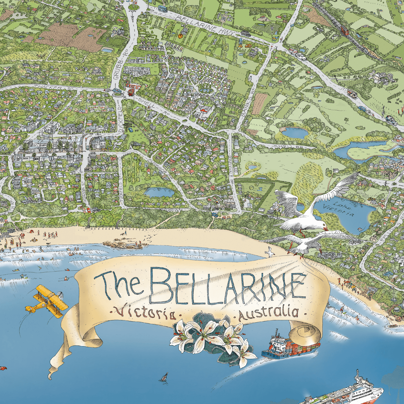
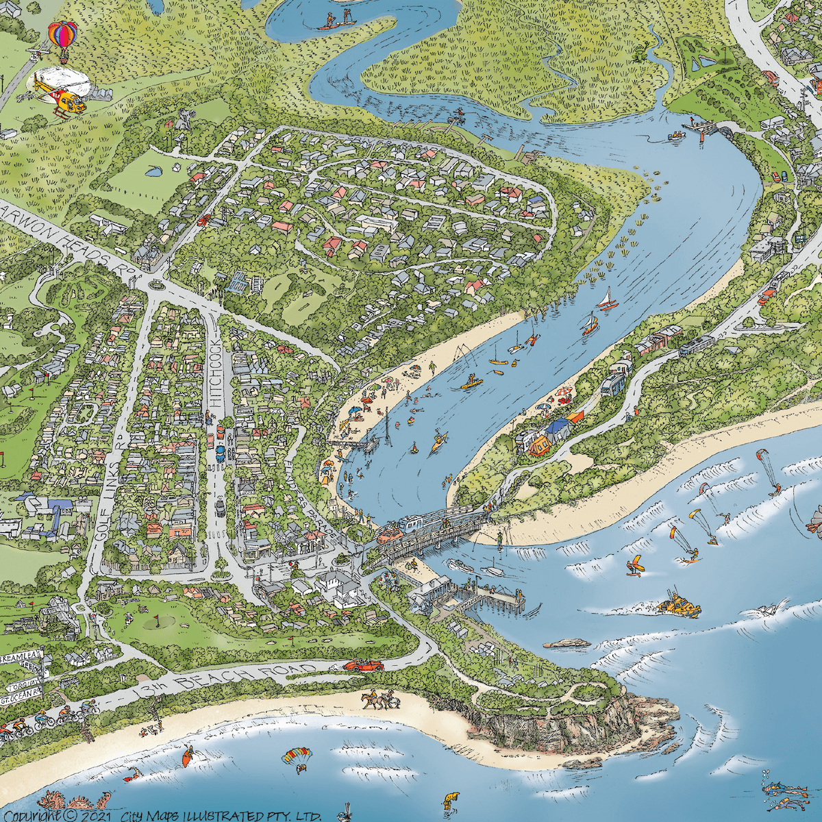
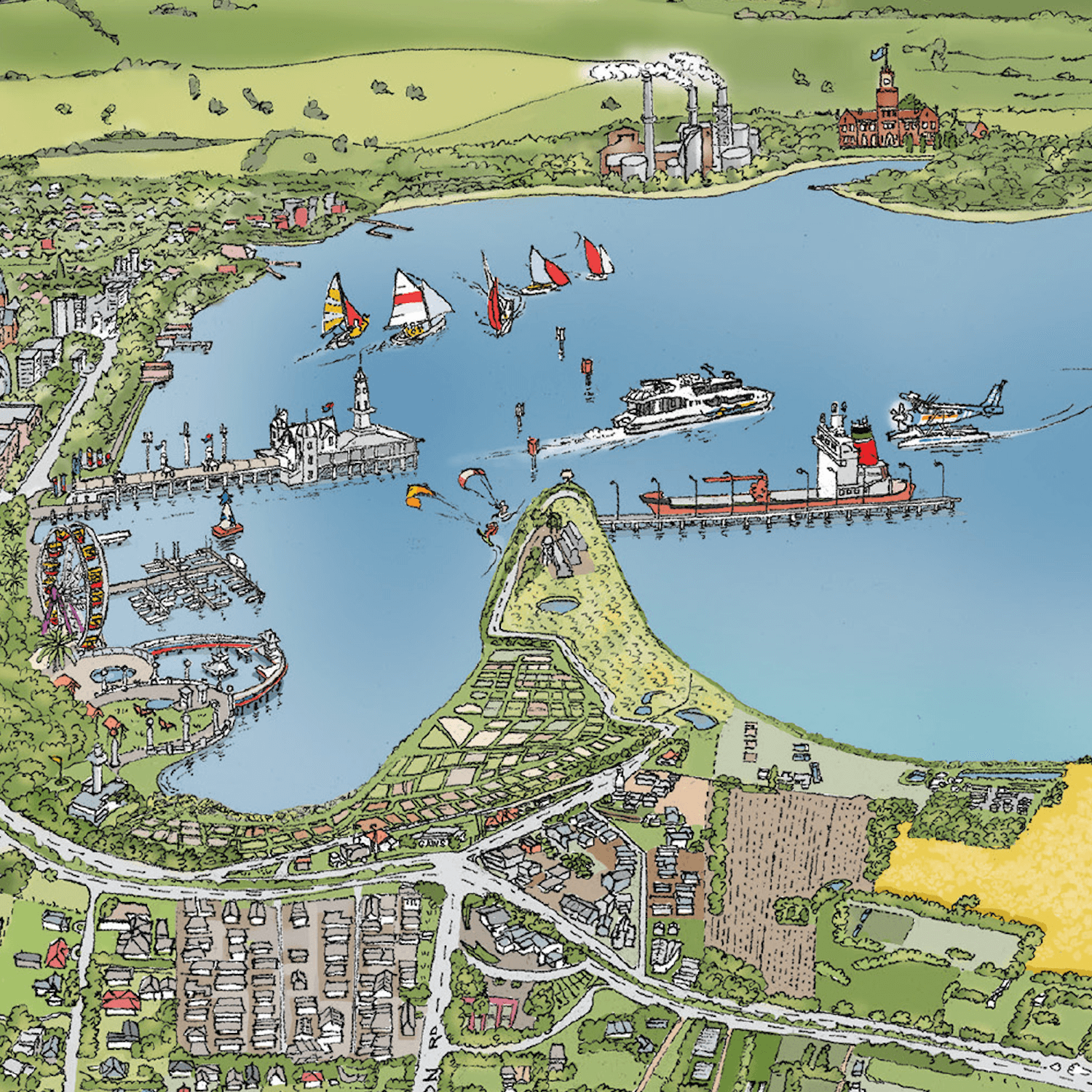
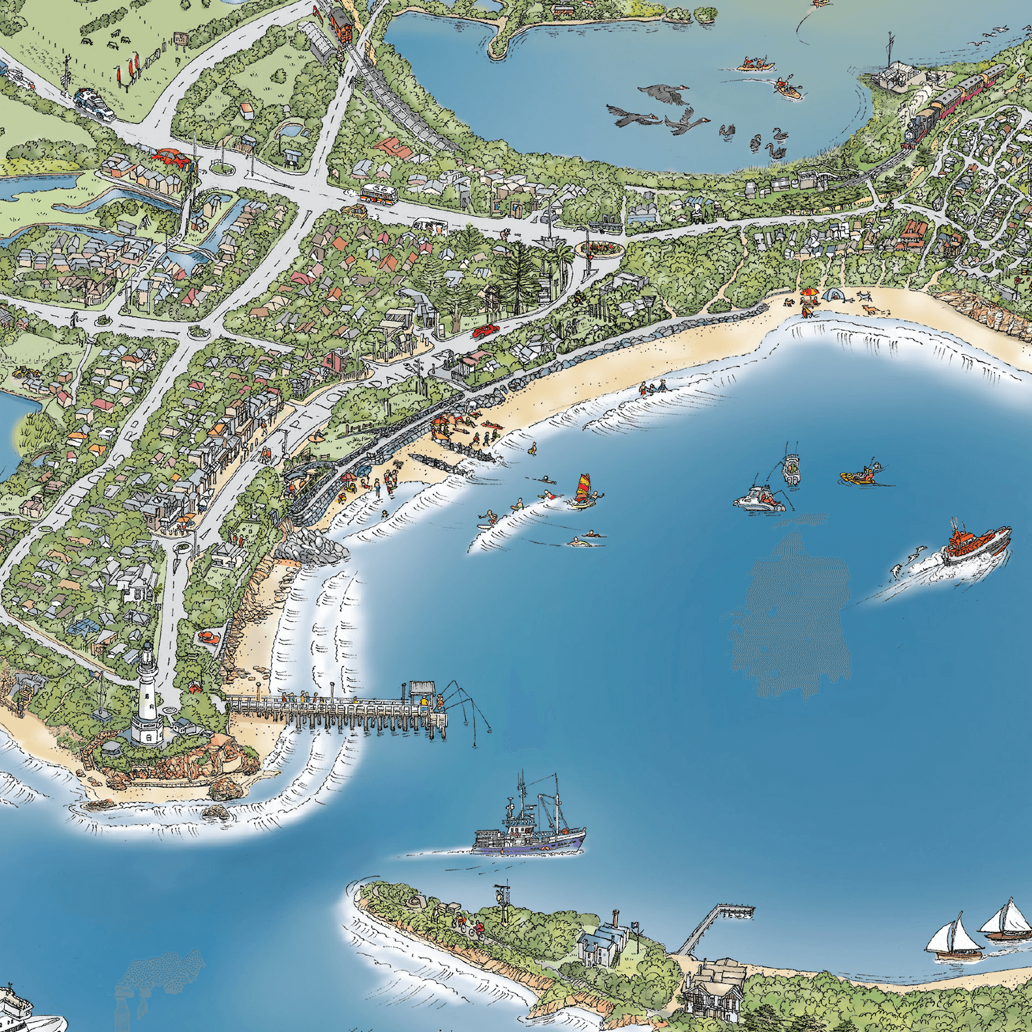
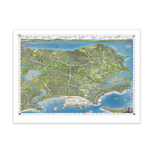
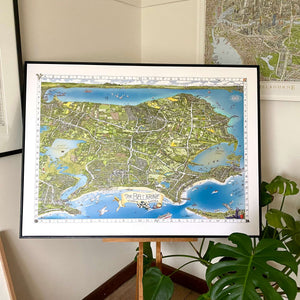
THE BELLARINE MAP - available in four sizes (unframed)
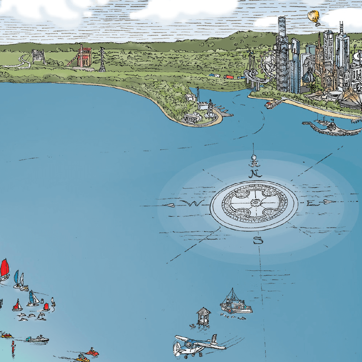
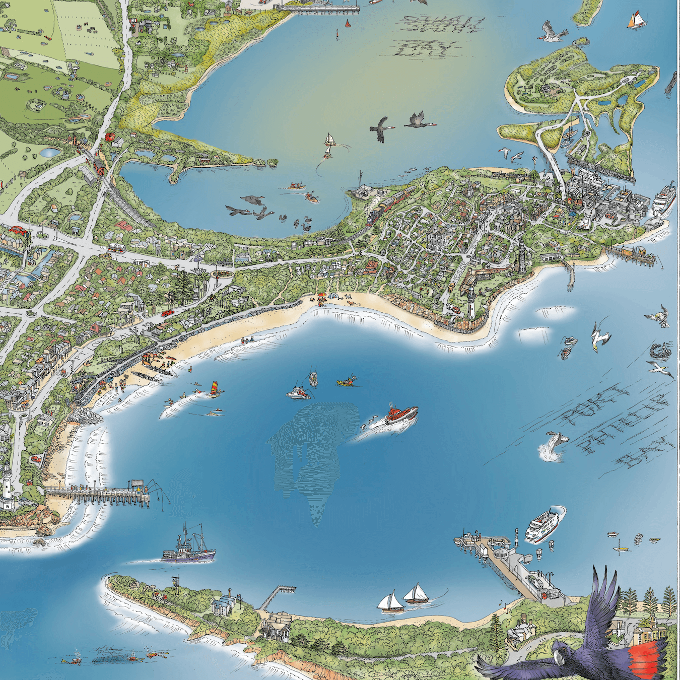
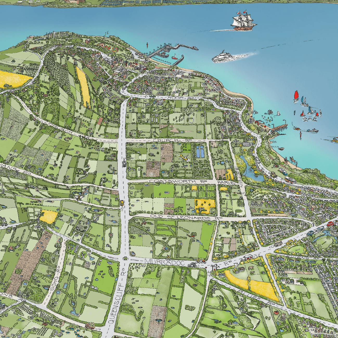
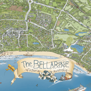
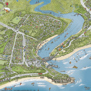
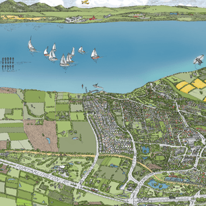
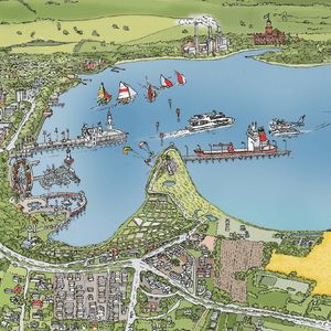
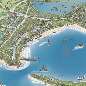
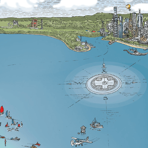
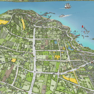
This joyful hand-drawn map of The Bellarine has it all - documenting the beautiful coastal vistas and everything in-between. Locals and visitors will cherish the capture of their favourite wineries, golf clubs, attractions, cafes, beaches, bike tracks, railways, ships, sailboats and ferries, water activities, wildlife, landscape and more.
Produced, hand-drawn, coloured and printed locally!
Areas covered include Queenscliff, Point Lonsdale, Ocean Grove, Barwon Heads, Marcus Hill, Wallington, Swan Bay, Mannerim, St. Leonards, Indented Head, Portarlington, Drysdale, Clifton Springs, Curlewis, Leopold, Moolap, a touch of Geelong, past the You Yangs and up to Melbourne - oh and a sneak peek of Sorrento and that other peninsula!
The Bellarine Peninsula is on Wadawurrung Country
Each print comes with a Grid Reference & "Can You Find?" list.
The Bellarine Map OPEN EDITION is available in four sizes (unframed)
A0 - 1189mm x 841mm - $195
A1 – 841mm x 594mm - $110
A2 – 594mm x 420mm - $95
If you would like a recommendation for local framers, please let us know. We welcome any inquiries - please contact us hello@themelbournemap.com.au
Price includes shipping Australia wide - if you live on The Bellarine/Geelong region we will hand deliver in the next few days.
International orders - please contact us before purchase, and we'll advise if we can deliver to your location - delivery costs will be additional
Also available as a Limited Edition Print - same size as original artwork
Join us and receive 10% off your first order with us