


$95.00
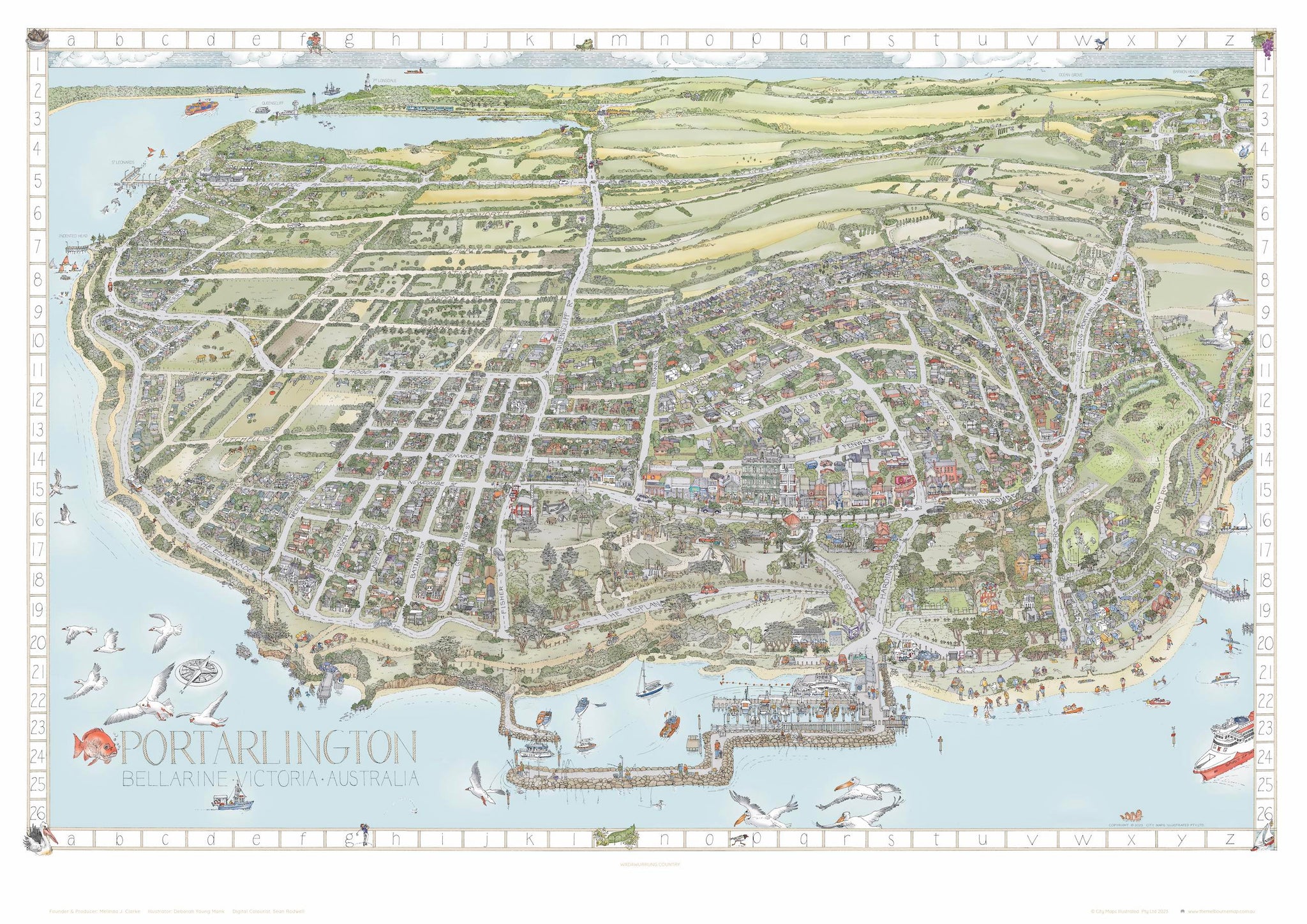
THE PORTARLINGTON MAP
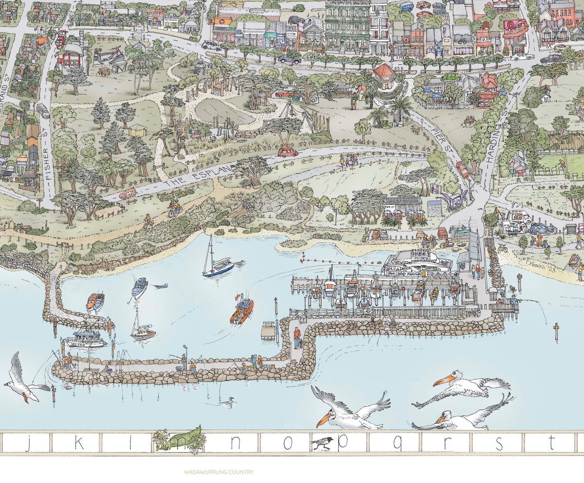
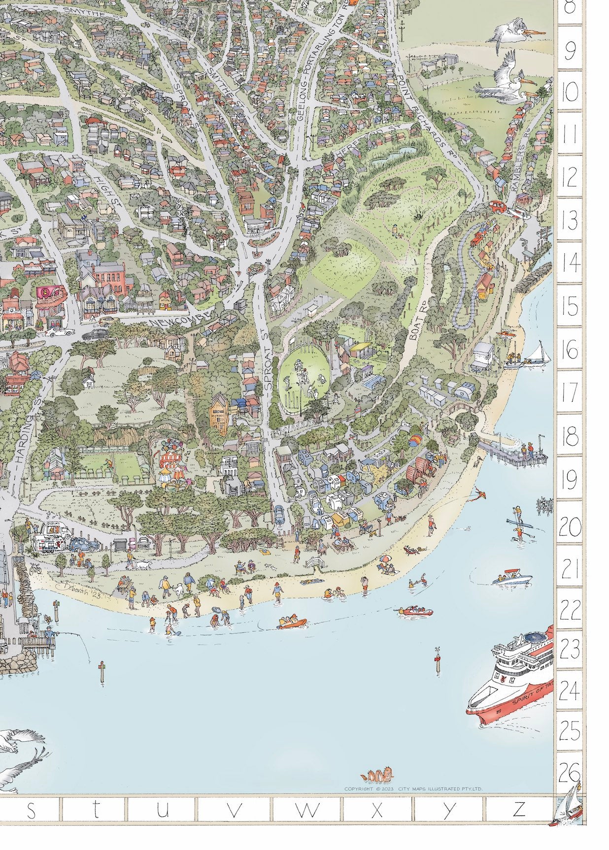
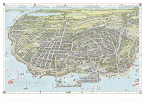
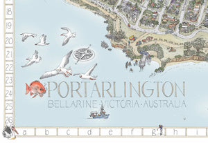
Here we go again, our latest map creation ...... we couldn't resist bringing you the features of Portarlington - a beautiful town on the northern tip of the Bellarine Peninsula.
Brought to you by the team who produced the Melbourne & Bellarine maps, more than 1200 hours of research, illustration and colouring have been invested in this project.
This beautiful artwork details your favourite features of Portarlington and the surrounding townships of Indented Head, St. Leonards, Bellarine and Drysdale.
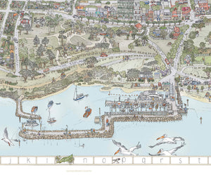
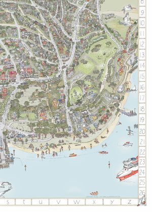
The incredible detail includes people, places, parks, playgrounds, wildlife, boats & ferries, vehicles, local traders, events, wineries, food and produce venues and so much more.
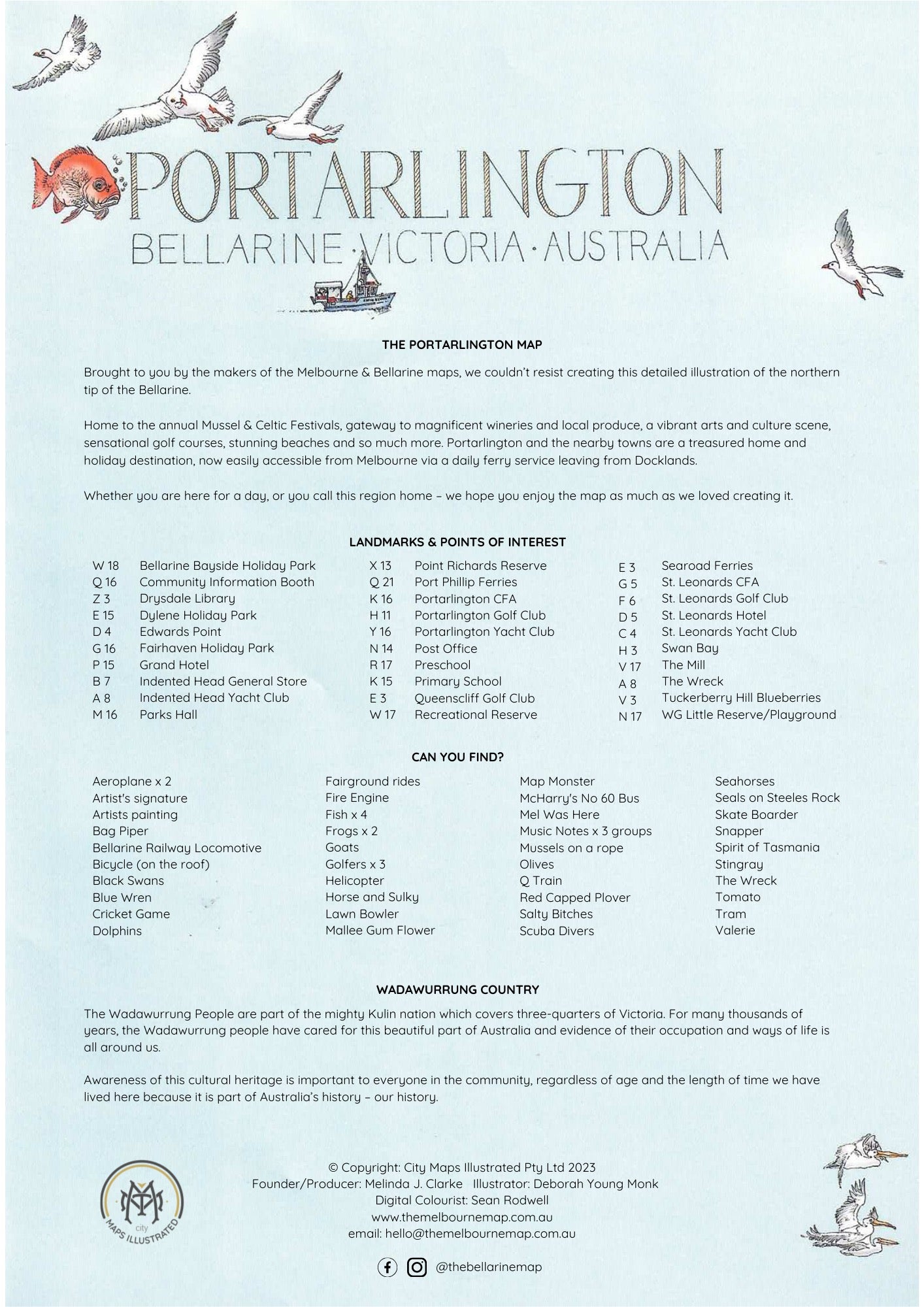
Each print comes with a page of Landmarks & Points of Interest & Can You Find? List
Limited Edition Print - A large print, the same size as the original drawing, printed on archivalHahnemühle German Etching 310gsm 100%rag paper, signed, numbered, embossed and Certificate of Authenticity. Only 150 colour limited edition copies are available. Print measures: 1189mm x 841mm NOTE: OUR LIMITED EDITION PRINTS ARE NOT AVAILABLE UNTIL OCTOBER - We are taking a short break. email hello@themelbournemap.com.au if you have any questions.
Open editions -Individual digital prints on quality paper stock.
We can recommend some fabulous local framers, please email hello@themelbournemap.com.au and we'll send you the details.
NEW folded version A2 folded down to A5 size -Do you want a copy of the map to share with visitors, or giveaway - here's a handy new version that we've printed onto an A2 page and folded down to a handy A5 size. The cover has the grid reference on the back and packed in a nice clear pocket.
Price includes shipping Australia wide - if you live on The Bellarine/Geelong region we will hand deliver.
Laminating available for open editions - please email and we can organise.
Producer: Melinda Clarke
Illustrator: Deborah Young Monk
Digital Colourist: Sean Rodwell
Scroll to the bottom of this page to subscribe to our newsletter for updates.
Join us and receive 10% off your first order with us